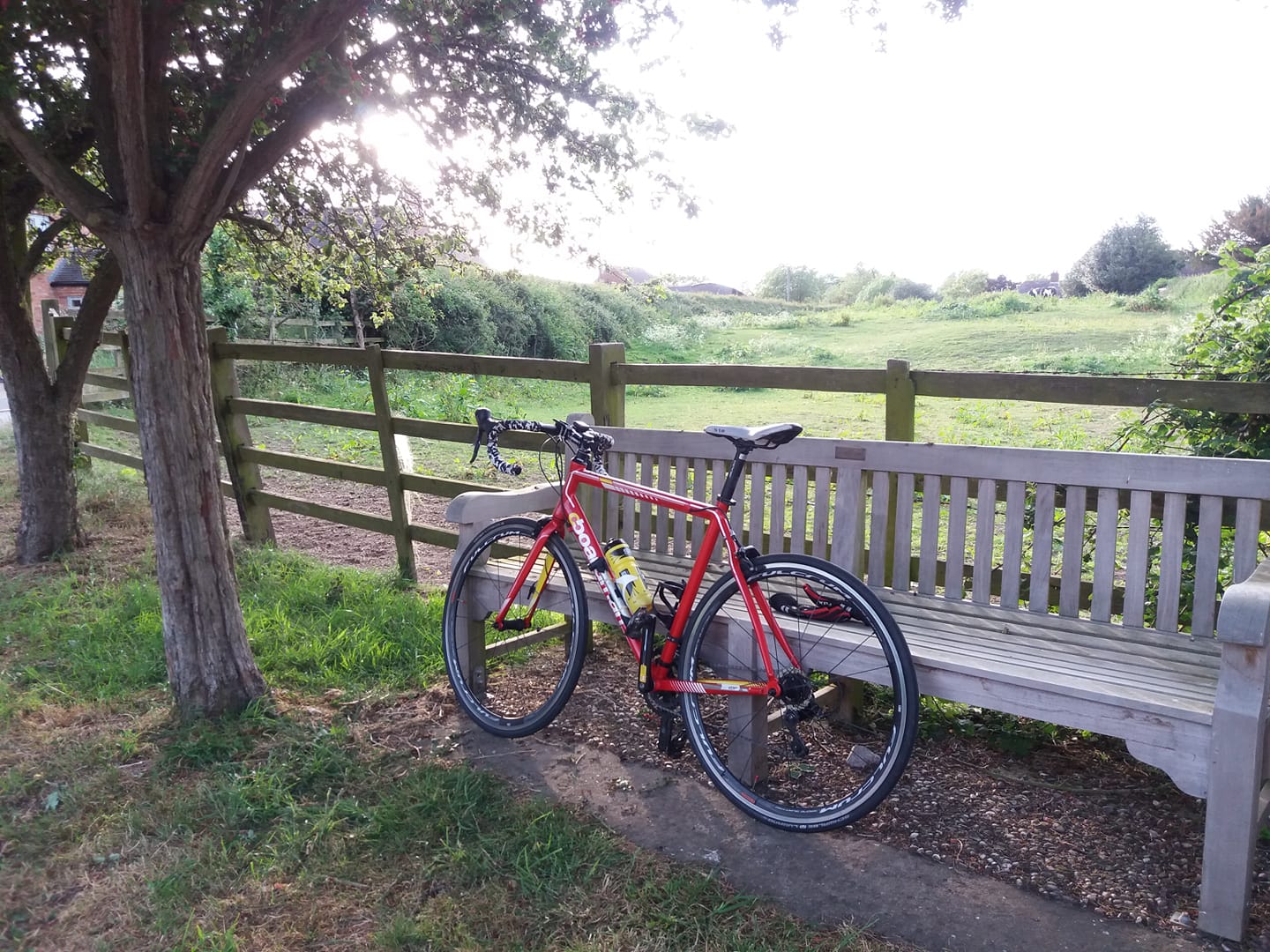
The weather forecast changed a couple of times today but by mid
afternoon it was threatening light rain for an hour or two. I had a
feeling that it wouldn’t actually rain though, and I was right. I took
the hybrid out at about 3:45pm.
I did a Twycross
with the same detour via Orton as the last one. It’s an increasingly
popular item in my repertoire; I shall know it henceforth as the
Twycross Bypasser. This was a shorter version than I did last time
though, without the deviation up to Packington over the first few miles.
I came back through Heather rather than Ibstock, as well.
The
right turn from the crossroads near Orton has a really long, steep
descent down a quiet road and I was tempted to take it, for fun – but of
course in cycling, what goes down must also come up, at least if you
intend to finish where you started. Wanted to
do about 25 to hike the monthly mile tally over 350, and I did 25.58.
That’s 712 this year, 357 this month. Happy to have done that as the
weather for the rest of the month looks rough.
Cold,
but sunny. Back just in time, well after sunset and I only had flashy
blinkers on the bike – but there was still enough light to see the road
in front of me when I pulled up at the garage door.
Lots of dead badgers around at the moment, sadly. Noticed another dead mouse in the garage. As always – quick.
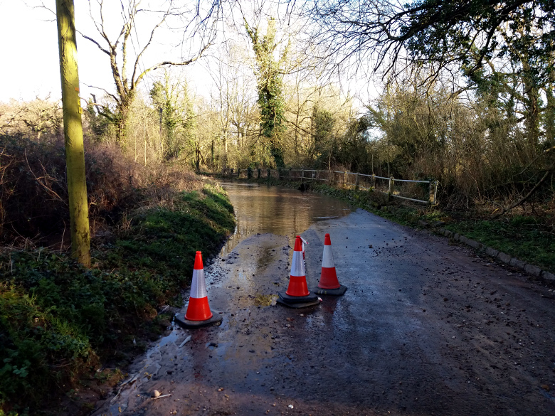
I had no firm intention of cycling today, but after a rainy morning the afternoon brightened up considerably. So off I went. I decided to do a Twycrosser – there’s just something joyous about riding over that way with footy on 5 Live, and United were playing Watford in the commentary game.
The
roads were rather wet though, so I took the hybrid again. I wanted to
do about 30, which would take me through my monthly target, and also get
me within an easy ride of hitting 350 for the month.
I actually bypassed Twycross completely by taking the larger detour through Norton and Orton. Really lovely along there in the sunshine, with views of Staffordshire for miles.
Just as I approached Sheepy an oncoming cyclist stopped me to warn me that if I intended to go straight over at the next T junction, the road ahead of me was flooded. He’d pedalled straight through it and got his cycling shoes wet. I had no intention of doing this in the first place – it’s not called Watery Lane for nothing and it’s muddy at the best of times – but I did go over to have a look.
Annoyingly
I dropped my right glove seconds before taking that last pic; it landed
in a shallow puddle and my hand was damp and cold for the rest of the
ride. Apart from that though I was warm enough until the last 45 mins or
so of the ride, when the temperature dropped markedly.
Windy again today, and I had to struggle against a strong headwind when heading westward. I did really enjoy myself though.
I
used my old Forerunner 310 to track the ride, and annoyingly it
switched itself off along Fenn Lanes. I’d already noticed that my phone
battery was on 6% when I’d taken one of the pics, so using the phone to
track the rest of the ride wasn’t an option. So I synthesised the
missing part and uploaded to Strava in two chunks:
Was tempted to do 25 or so yesterday. No rain, very windy. I’ve been out
in worse conditions certainly but I decided against it. Cycling is a
bit like alcohol. Make sure you’re in charge of the bike, not the other
way round. Keep it fun.
Instead I had a think about the logistics
of doing a 100 miler, when conditions and circumstances allow. One
approach might be to think what might be the 100 mile route from my
garage door with the minimum possible elevation gain. Of course it would
have to be a reasonably linear route, no cheating by doing multiple
laps of convenient flat bits.
To this end I conducted an exercise
with the Strava route planner. As some readers will be aware, it has a
‘minimum elevation’ function which purports to find the flattest route
between two points. Now as it happens the routes it finds tend to be
fairly rubbish, sometimes including sections of track that a reasonably
sane off-road cyclist would think twice about.
However I
conducted an exercise that I thought might be instructive nonetheless.
What I did was this: I dropped the destination pin at 8 points on the
route planner map, each roughly 50 miles from base – north, north-east,
east, south-east .. and so on. I was interested to see which direction
required the least climbing, and by how much.
The results are as follows (in feet):
N
1694
NE
554
E
1567
SE
1382
S
1012
SW
1311
W
903
NW
1111
Now
of course the route wouldn’t have to be a straight line. Nothing wrong
with a slightly L-shaped or jagged route. Furthermore elevation is not
the only critical factor – the quality of road surfaces is quite
important as well, for example. But it is a pretty important
consideration.
So I think the results are quite interesting. There’s a sort of corridor of flatness extending to the north-east from my house, roughly following the River Severn.
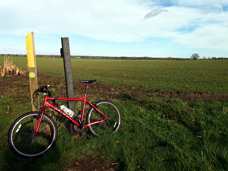
The plan was to have another day off cycling today, and do 50 or 60 miles tomorrow. But the forecast changed to rain and 40mph winds for tomorrow, so since this afternoon was relatively dry, I left work early with thoughts of doing 25 or so. I took the hybrid.
Unsurprisingly,
there’s a lot of standing water around, though it hasn’t rained today. I
did a sort of sub-Twycross. I’d had enough of the strong sidewind by
the time I got near Twycross. I’d literally been blown sideways onto the
grass verge at one point. So I took a left at Little Twycross, after
which it became a tailwind and I started to enjoy myself a bit. So I
extended my ride by continuing across to Ibstock to hang onto the
tailwind for a while, and came home that way. Back just after sunset.
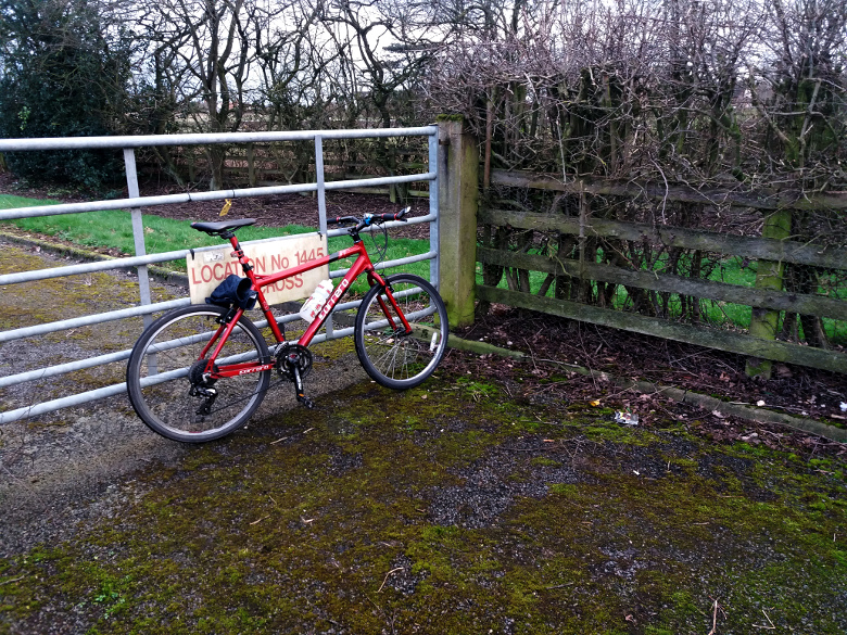
About a second after I took this pic at the “unmanned unodourised gas station” just outside Twycross, a gust of wind blew a glove from where I’d perched it on the bike, through the gate. So I had to defy the “no unauthorised persons” sign and climb over to retrieve it.
21.81,
which takes me to within 7 miles of this months “adjusted” target,
which is 299. But I hope I can do another 60 or so at least. The weather
forecast looks hostile, however.
Today’s weather forecast promised a bit of rain in the morning then a
dry afternoon, so I planned to leave work early and do about 30. But
when I checked it again at about 2pm it had changed its mind, now
threatening light rain at 4pm-ish.
So I decided on an extended
lunch break ride instead, and set off on Neil at about 3pm. I’d actually
decided on the hybrid due to the likelihood of precipitation but I’d
put my cycling shoes on before I remembered that it doesn’t have clippy
pedals any more. FFS.
Anyway – I did a Twycross. A slightly
unusual one in that I came back through Ibstock. I didn’t fancy Heather
Lane much in those conditions.
Took the following pic at Sheepy Magna.
Not
too cold. It didn’t actually rain save a few cold, sharp spots south of
Ibstock, but the roads were running with water here and there and
Neil’s nether regions were splashed. But he got a bloody good seeing to
with GT85 on returning to the garage. I’ll have to relube it tomorrow or
on Wednesday.
Very blowy. Quite an annoying sidewind from time to time in exposed places. Back about 20 minutes after sunset.
Came up to Hartlepool for a few days on Thursday evening and the weather
forecast suggested that yesterday morning was my only opportunity to
get out on Boardman II, now resident in my mum’s garage. Not exactly
ideal conditions though with a strong wind blowing from the south due to
intensify to 40mph+ by noon-ish. I set off at about 0900.
Fortunately
my usual run out from chez mum takes me down along the coast, so I’d
have a tailwind on the way back. I thought I’d do the Transporter Bridge
and back, as usual.
Really cold, especially with a rather fresh wind in my face along Seaton Carew. On the way down I passed a road I’d never noticed before, signposted ‘Coast Path’. I took that for a mile or two. Nicely surfaced but the views were predominantly of rough ground and chemical works. After a mile or so that came to a dead end, effectively – it continued as an unsurfaced path down to the sea – so I turned back and rejoined the usual route. Not a very interesting diversion really but a welcome respite from the oncoming icy blast of the North Sea air.
Got
within half a mile (at a guess, I haven’t checked) of the Transporter
but the crumbly road surface was annoying me so I took another left,
along the Seal Sands road. A bigger and busier road than the previous
impromptu diversion but a similar story; mostly chemical works and
ultimately a dead end. Turned back and went straight over the roundabout
for a bit rather than turning right for home. But after a few hundred
metres the road started to curve northward, meaning of course that I’d
have a headwind again coming back and I’d had enough of that. Did a U
turn back to the roundabout and turned for home with the powerful wind
behind me. Joy. As an experiment I stopped pedalling for a couple of
minutes and did about half a mile purely propelled by residual momentum
and the wind, albeit not at any great speed. I sat upright to present
the biggest possible profile behind me and actually picked up a bit of
speed at one point.
A bit of faffing around once I got back into
the town, mostly looking around old haunts, including my old walk home
from school (or some of it).
The thought occurs to me that if I
ever do that ride up here from Leics, a strong wind from the south or
south-east will make life a lot easier.
Nice run out, anyway. 22.97 miles and that’s exactly 600.00 this year.
With the wind coming from the south and due to intensify in the
afternoon, a run out down south seemed to be the best plan. I thought
I’d have a crack at Northamptonshire, via the usual (or more recently
usual) route down to Welford. And that’s what I did, but not at first. I
left the garage at about 08:30 and after about three miles, realised
I’d actually commenced the eastward route, which starts in pretty much
exactly the wrong direction.
Rather than stop and do a U turn,
which would have been bad for morale, I decided to keep on a bit then
loop back through Whitwick. And I did that, though not before getting
lost along a road that ended at a farm for a mile or so. But I found my
way back to the intended route before long, having done roughly 7
spurious miles. I wasn’t really bothered, though. I’d been thinking of
tacking on a few at the end anyway, to get the distance up a bit over
the 80 mile mark.
If readers are concerned that the above sounds a bit like an early onset dementia symptom, please don’t be. I’ve been like that at least since primary school. My teachers used to despair of my absent-mindedness.
Very
pleasant run down through Newbold, Kirkby Mallory, Earl Shilton, Stoney
Stanton et al. The closed road I’d encountered at Broughton Astley last
time I came this way was still closed but I was able to bypass the
roadworks along the pavement very easily. I was a bit too cold,
actually. Hadn’t quite wrapped up warm enough. But I was fine when the
sun came out in the afternoon.
Arrived at Welford and decided not
to take a pic of the Northamptonshire sign, as it was surrounded by
standing water and I would have got my shoes wet. After a snack at a
bench in the village I kept on for a bit, and turned for home after
about 42 miles. I’d forgotten to bring a pump and I felt I was pushing
my luck going too far on tyres well into four figure distances. Really
must change them in the spring. I was already mentally rehearsing a
provisional explanation for calling the wife out 40 miles from home.
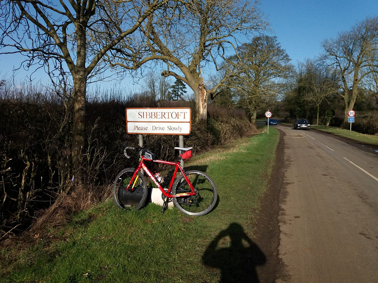
I was using the eTrex for navigation, having done that full route only once before – and on the way back, north of Welford I noticed that I was no longer on the purple track on the display, denoting the planned route. I decided to take a right to a village called Sibbertoft that was signposted, and work out a way back from there. I’d been meaning to do a bit of a diversion to get the distance up a bit more anyway. This was a really pleasant interlude that took me past a gliding club. I saw a couple of gliders circling overhead. Got to Sibbertoft, stopped and consulted Google Maps and realised I just needed to turn back the way I’d come. I hadn’t actually left the planned route at all, when I thought I had. The eTrex must have flipped to standard map mode due to a misclick. Or something.
Stopped at the village shop / coffee shop at Gilmorton on the way back and had a sandwich, lemon curd shortbread (yum) and a coffee. I reminded the girl behind the counter that she’d had to call someone to explain to her how to use the coffee machine last time I was there, but she has the hang of it now.
Slightly bothered by sidewind on the way back, here and there. The headwind on the way down wasn’t too bothersome and on the way back, mostly I had a tailwind. Always a comforting sight to see a wind turbine spinning merrily in your direction when you’re on a bike.
Back home much the same way, except that I took a wrong turn at Kirkby. Google Maps suggested that it went to Desford so I pressed on, but it devolved into a muddy track after about a mile. So I turned back.
Back home just at sunset on 85.4 (Strava says a bit more, but I’ve subtracted from that to compensate for clogging round the shop and wee stops with the watch on).
I’d made a slight adjustment to the saddle height as an experiment before setting off – raising it by about 7mm – and that did seem to make a positive difference. I don’t doubt I could have done another 15 miles but didn’t want to push my luck, and in any case it was getting dim and I only had a flashy blinker on the front. In any case I’m very happy to have done 85 miles without too much trouble (knees feel a bit sore now but nothing sinister). I will work up to doing a 100 miler. I could certainly choose a flatter route than that one, anyway. Maybe 92 next time, perhaps in warmer weather on a longer day.
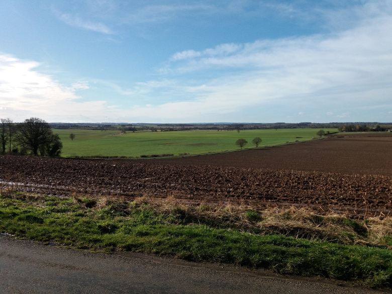
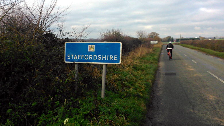
A nice, dry day. Wanted to do Staffordshire and back, to tick another of
the “neighbouring counties” boxes. The nice way to do this would have
been to take the usual westward route over to Walton on Trent, but
there’s a considerably closer entry point at Clifton Campville, some way
to the south. I don’t go over that way much these days because of the
awful road surfaces and the need to cross over the M42 using a busy,
multi-lane roundabout but I wanted to get it done after work today, so
that was the option I took.
I decided that the Tricross would be weapon of choice, to soak up the aggressive road buzz with its fatter tyres.
Arrived at the Staffordshire border on about 10.5 miles – definitely low hanging fruit. I’d already taken Warwickshire in for half a mile or so, but I’d already done that one on Monday. It has a nice, shiny new sign – here’s a pic I took in 2015:
Sort of prefer the old one, to be honest.
A few miles later I saw a sign to Lullington, which is on the more agreeable route out west – so I took that. I hadn’t done that road between Clifton and Lullington before but it was very quiet. Involved more climbing than I wanted though, really.
Back home the usual
way from Lullington, through Measham. I suppose the best thing to have
done, to avoid the poorly-maintained road surface and the roundabout,
would have been to use the same route for the outbound part – I just
hadn’t thought of turning off that route to go south to Clifton. I only
remembered that it doesn’t hit Staffordshire for at least 20 miles if
you keep going straight.
Very atmospheric out there after dark, again. Really enjoying these starlit evening rides at the moment. Bit cold though.
Anyway – 26.07; 136 this month, not bad for 5 days in. 492 miles done this year, 292 more than this time last year.
Left work earlyish – not as early as I intended, but one of my idiot colleagues pushed back a meeting by half an hour then cancelled it at the last minute. Anyway I did get out of there at about 15:45.
I’m hoping to do all the neighbouring counties of
Leicestershire again this year as usual and last night, I had a look
through the tracks I’ve already done in 2020 to see which ones I’d
ticked off already. Only Derbyshire and Nottingham, as it happens.
Frustratingly I stopped a couple of hundred metres short of the
Staffordshire border before turning back on my trip out west on
Thursday. Anyway I noticed that I could take in a bit of Warwickshire by
extending a Twycrosser to the west a bit, so that’s what I did today.
Turned off the main road down to Twycross to go through Norton, Orton
and Warton. I wasn’t 100% sure I’d been into Warwickshire until I
encountered a ‘Leicestershire’ sign on the way back in. Why can’t all
public roads have signs to tell you when you’re entering a different
county?
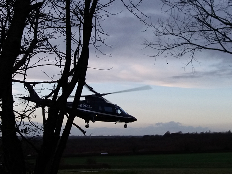
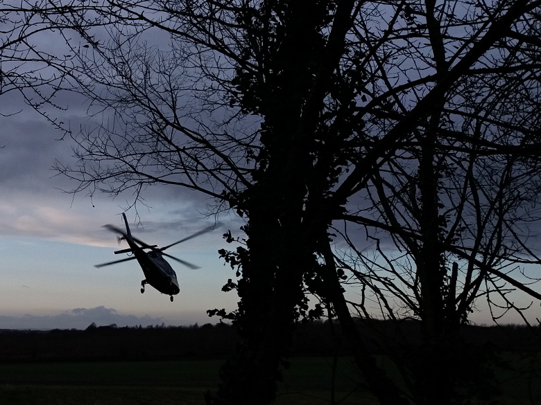
A few minutes after I set off I noticed a helicopter crossing overhead, then about ten minutes later I saw it sitting in a farmer’s field, not far from the road! I stopped to take pics. The pilot appeared to be consulting a map, and he took off again not long after I stopped.
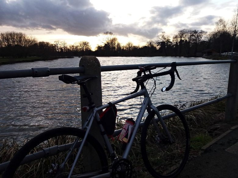
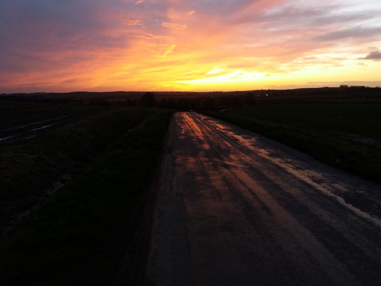
Absolutely beautiful out there in the open on the quiet road between Norton and Orton. Noticed the orange light from the setting sun ahead of me reflecting beautifully off the shiny patches on the road, so I stopped to take a pic:
That’s pretty much untouched apart from being resized; straight off the phone.
Dark
not long after that of course but I had highly adequate lighting. And I
wore a helmet, again. Good that I’m getting back into that habit, I
must admit.
Roads mainly dry. Not too cold. A bit windy.
Back
on 31.72 miles. The old bike computer I put back on the Boardman
behaved properly. Hopefully cleaning the contacts has fixed it.
I
must do that extension more often; it extends a Twycrosser nicely
(non-Twycrosser might be more accurate, it actually bypasses Twycross by
about a mile). And it’s a nice, quiet stretch with nice landscape
visible for miles.
I woke up unusually early this morning – excited, to be honest, about the UK no longer being in the EU. By about 05:30 I was wide awake so I decided to get up there and then. Had coffee and toast. Donned my cycling clothing and withdrew Neil from the garage at about 06:45.
I was pressured last night by ‘er indoors into wearing a helmet today, for a change. I wore a thin cycling hijab underneath it and a helmet cover on top and it was warm enough. Perhaps I’ll do that more often. This was the first time I’d worn a helmet for a couple of months, if not longer. A woolly hat is preferable for cold weather cycling really, but not necessarily for smooth marital relations. Of course I do appreciate the concern.
Dark out there an hour before sunrise, but
delightfully quiet. I’m on call at the moment so pursued my usual
strategy of trying to stay reasonably close to base. I decided to head
up toward Donington, taking a left to Melbourne then over Swarkestone
Bridge, then turn left to go west for a few miles along the long, flat
stretch north of the Trent. After that I’d come back south passing close
to base, and noodle around southerly parts for a while. But I didn’t
have a definite route in mind.
Very windy out there with powerful
40+ mph gusts forecast for a couple of hours around noon. I knew I’d
have a headwind going west, but the tailwind on the way back would make
up for it a bit. As it turned out the headwind, at least at that time of
the morning, wasn’t too severe.
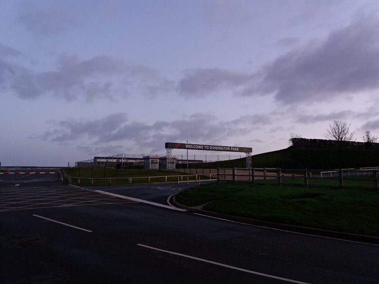
Turned into Donington Park on a whim on the way there, to have a look just after dawn.
I
was genuinely thoroughly thrilled to be taking in the sights of an
independent country, no longer in the EU. The air smelled sweeter. More
British. The countryside seemed more precious, and more noble.
Got
as far as Hilton – a bit out of my comfort zone for receiving calls
from work; the quickest way back from there is probably about 18 miles –
and turned around. I definitely felt the tailwind after that. Rather
than coming back down Swarkestone Bridge though I decided to keep going,
and keep the tailwind, as far as the town of Donington itself. I
stopped at either Weston or Aston for a sandwich and a packet of Skips
from a shop there. Hadn’t been along that road before, at least in that
direction, and I took a wrong turn out of Aston, but ended up going
through Shardlow and over Cavendish Bridge as intended anyway. I hadn’t
actually realised that I’d done that until I looked at the uploaded
route on Strava.
Back
down through Isley Walton and Breedon then to Coleorton through
Worthington and Newbold, which I haven’t done for years. I was pretty
much busking it at this point but had a rough idea to go over to
Packington and tack on most of a Twycrosser. And I did that until I got
to Snarestone, having done 60 miles. I was pretty much running on empty
by this time, not having had a great deal of sleep last night. But I
decided to refuel at the Alpaca Farm caff, then either just make my way
directly home from there or turn back to the road down to Twycross and
keep going.
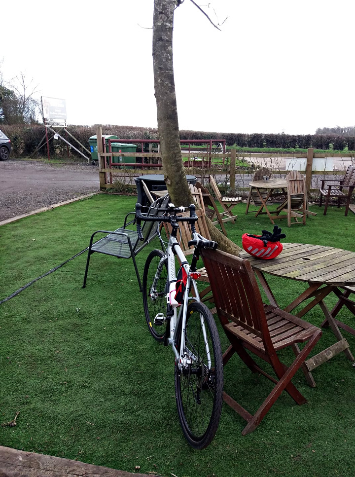
I
sat outside and had a scone, clotted cream, jam, coffee and a can of 7
Up. And the little biscuit that came with the coffee. Even after
ingesting all this I decided to head straight home, but after pedalling a
mile or two noticed that I now had a lot more energy and mojo. A rest
and refuel stop makes a big difference. I’d come a bit far now to turn
back down to Twycross, but I continued to Heather and from there crossed
over to Ibstock, from where I thought I’d do a bit of the standard
route down south. And I did do that but by the time I got to Barlestone
Road, out in the open again and a bit more exposed, the wind had become
fierce – just staying on the bike was becoming a bit of a drama. So I
came back home the shortest way from there.
Home on 78.56 miles. Nice to have done the February Fondo on the first day.
Almost spring-like weather when the sun came out. But it rained lightly a couple of times, not for long though.
Still no sign of the squeak from Neil’s rear and even the secondary rear disk lever is working properly now – still feels a little sticky but doesn’t jam the brake.
My
knees are sore now. But I’m encouraged to have done that distance
without hurting them too much; the longest ride since I buggered them in
April 2018, though only by a couple of miles. With a more carefully
planned (flatter) route, lighter clothing / bike and no headwind I feel
fairly confident I could do 100 or a bit more.