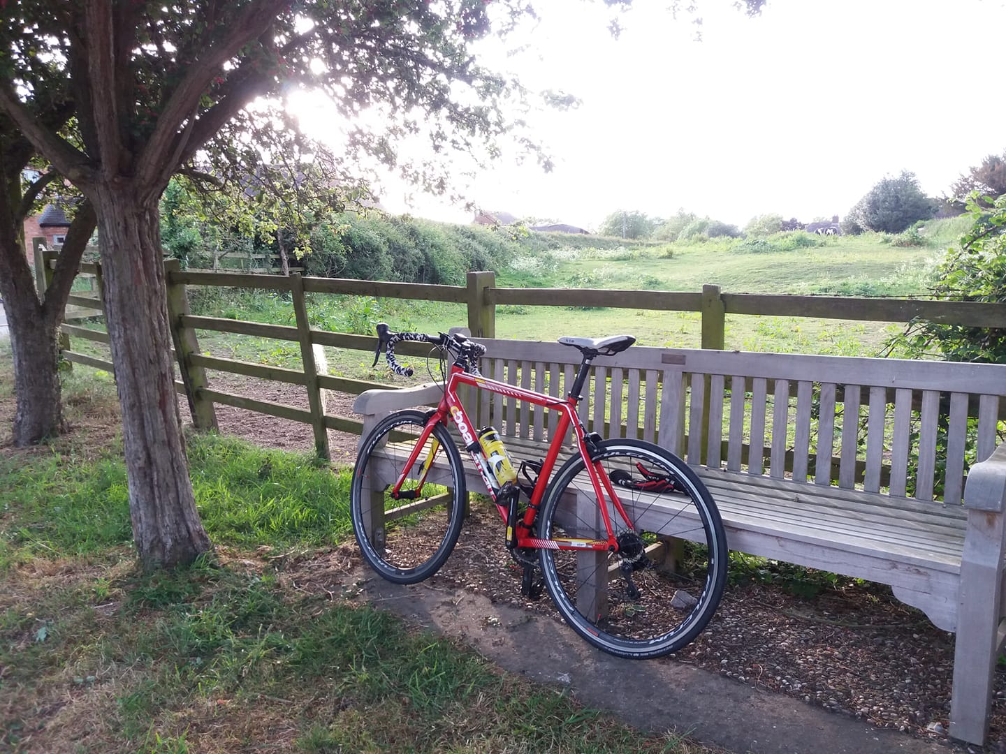
Cold day today. I was comfortable enough on the bike, but I had to wrap
up warm. The Boardman was selected as weapon of choice since there were a
few puddles around, and I set off at about 11:15.
With a
strong-ish wind coming from the north, the intention was to go north,
then west along the long A road under Derby, then back. I only wanted to
do 35 miles or so but I was on call, so I tried to pursue the usual
strategy of not wandering too far from base.
I went up through
Belton to Long Whatton where I turned west for Melbourne then over
Swarkestone Bridge and westward as far as Willington. Then I came back
down Top Brand, rather than continue on to Long Whatton.
Mostly
cloudy, but the sun did come out for about five minutes! And
unfortunately an unexpected and persistent rain started about three
miles from home.
I mostly listened to my Jack Reacher audiobook.
The second half has gone a bit incoherent; almost surreally implausible.
It’s as if the author developed a powerful drink habit after writing
the first 20 chapters or so.
My Garmin bike computer gave a low
battery warning on the way down Top Brand but fortunately I had a GPS
watch on so I used that for the last eight miles, and concatenated the
tracks when I got back.
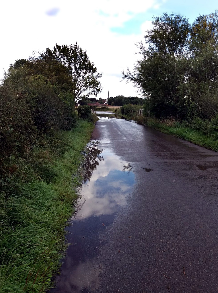
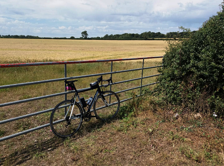
I wanted to do at least 34 after work to get the August mile count up to the ‘recalculated’ target, 530 miles. Hadn’t done a Twycrosser for a while so I set off on the S Works shortly after 4pm. I did the Orton detour from Twycross, the long way to Sheepy Magna. From there the plan was to go along Mythe Lane and Atterton Lane to Fenn Lanes, but I was confronted by this familiar sight from earlier in the year, along Mythe Lane:
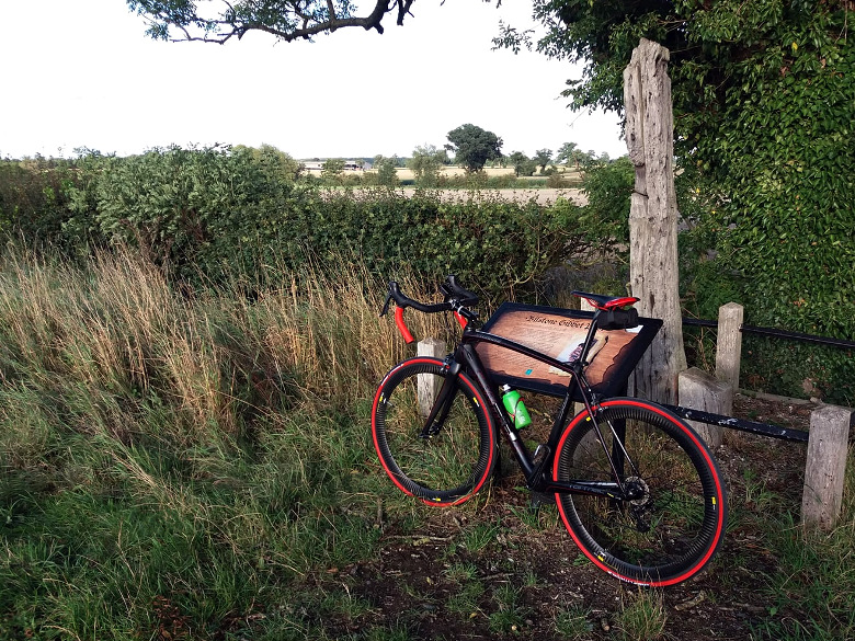
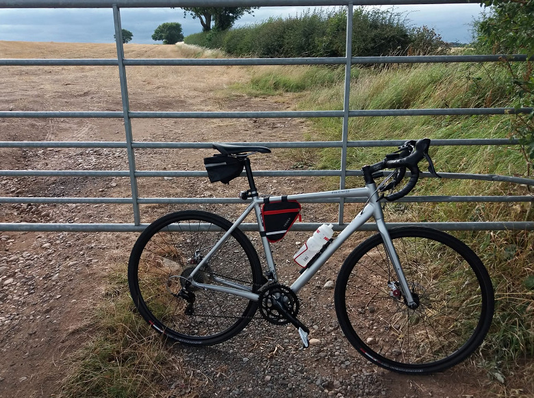
I turned back the way I came and turned off for Ratcliffe Culey and Sibson; a shorter version of the Twycrosser. Decided to come back along Gibbet Lane since I hadn’t done that for a while. Bad move – it was littered with dried mud and little stones for the first half mile. I took this pic at the Gibbet Post:
I’d
intended to take a right along Barton Lane from Congerstone, which
would have seen me arrive home on about 36 miles at a rough guess, but I
got a call from work at Shackerstone. As it happened our Global
Operations Centre had called the wrong person first for this particular
issue, so I asked them politely to call the right person instead.
However I felt sure that it would escalate up to me 20 minutes later, so
I took the quickest route home from there and put my boot down a bit.
Home on 33.02 miles, which takes me to 529.28 recorded miles in August,
0.72 short of target.
The weather looks iffy for the next couple of days, but the long weekend is looking good at the moment.
In
the interest of maintaining the rigourous intellectual honesty for
which I hope I’m renowned by now, I will state that I digitally removed
two items of litter from the second photo.
Beautiful cycling day, today. Sunny, not too warm, low wind. Great shame
I had to work, but at least I was able to down tools by 3:30. I decided
to take the S Works – conscious that the summer is not with us that
much longer, and I haven’t actually been out on it since I put new tyres
on. I wanted to do 46 miles, to take the August total past 500.
I decided to go up through Melbourne, over Swarkestone Bridge and along the A road that runs along the river. I did that as far as Willington then turned back, a little nervous that I was straying too far from home when I might be needed at work. I did go exploring along an unfamiliar road at Willington before I turned for home, but only for half a mile or so.
I
didn’t turn back down over Swarkestone Bridge. I kept going through
Weston and Aston. I had the vague idea of finding a turn to take me
south again, but actually there isn’t one until you get to Shardlow and
Cavendish Bridge, so that’s where I ended up. From there, back down
through Donington and the usual way home from my old office there.
It
annoys me when people spell it “Donnington” as they sometimes do, but
interestingly as I pedalled through the town I noticed an ancient road
sign – one of those pillars set in the pavement with distances on two
faces – with that same spelling. It must have been there since before
the war. Odd. Perhaps the name was changed at some point.
Saw a
couple of photographers with very powerful long lenses – amateurs, I
think – scrambling down the embankment to the side of the road as I
passed the airport. I’ve heard of people being harassed by the airport
security and police for unauthorised photography around the airport
perimeter.
Anyway – I only did 41.59 miles. If I’d come back down
a bit sooner I might have tacked on a part-Twycrosser, but I wasn’t
going to faff around just for the sake of another three or four miles.
So: 496 this month. I think the weather will allow another 80 at least.
The forecast was for rain all day and I didn’t think I’d have a chance to get out on a bike today. I finished work at 5:30 and conditions looked pleasant enough – blue skies, warm-ish and the roads were drying up nicely – so I thought I’d risk 20 or so on the Boardman.
Actually
very pleasant out there; not much wind and intermittent warm sunshine. I
pedalled over toward Hathern then hung a left to Diseworth. I would
have come back down from there but I decided it wasn’t going to rain,
and I pressed on a bit further, to skirt the bottom end of the airport
at Donington and back down through Isley Walton.
As I turned
southward I noticed mildly threatening skies a few miles ahead. Not only
that, but there was an indistinct, partial rainbow to the east (of
course – this being only a couple of hours before sunset). The rain
started not long after and continued intermittently for the next half
hour, but it was very light. The bike and I pretty much dried off
completely during the last 15 minutes, after it had stopped.
Very
pleasant excursion despite the mild precipitation. 23.76 miles. Even
when the forecasters threaten rain for a week, you usually get at least
one window of opportunity for a bit of a run out – and today was a case
in point.
Rain tomorrow but the rain expected today had vanished from the
forecast, so I decided I’d do a crafty 25 or so. I started off along
Ashby Road and Alton Hill without a clear idea of where I was going to
go. Took a left along Coleorton Lane to Packington.
Usually I’d
do a Twycrosser from there, but I’d determined that the wind was coming
from the NE from the orientation of a nearby wind turbine, after
consulting the compass on my Edge 130. So I thought that maybe I’d head
out east for a bit. Very unusually, I took a right towards Ashby at the
junction near Willesley Park Golf Club, rather than the left that would
have taken me down toward Twycross.
Went into Ashby. Decided from there to take the road to Ticknall through Smisby, but the diversion for road works that I mentioned in my post yesterday confused me, and I ended up taking an unfamiliar road to a village called Boundary. From there though I found the A511, as pictured below – so I headed down that for a bit. I knew there was a turn for Ticknall along there.
I
somehow managed not to find Ticknall. I’d been along that way many
times, but nearly always in the other direction. I missed a left turn.
Very nice to be doing Bastard Hill in a downward manner, though.
Anyway
I followed signs to Melbourne. These took me to the B587, the usual
road to the South Derbyshire town bearing the name of an Australian
city, and I came home the usual way from there, through Coleorton.
My casual adventuring caused me a lot of hill climbing, but my knees didn’t seem to mind. Back on 20.90 miles.
The weather looks iffy for the next few days. Had to be at home at
7pm-ish, but I left work at 3:15 on the X with the hope of doing 40
miles, to get the August total over 300. I started by going over toward
Ashby with the thought of doing a long-ish Twycrosser, but on a whim I
ignored the usual left turn to Packington and went right into Ashby.
I probably would have taken the right turn from the roundabout on the high street to head toward Ticknall, but it was closed off. So I just kept on, up the hill out of Ashby toward Moira. I didn’t really know where I was going; I just thought I’d follow my nose. I think I’d only been along that way once before, on my first bike trip to Stafford, a few years ago. Eventually I came to a crossroads with a sign to Twycross down the A444, so I took that. Definitely hadn’t been along that whole stretch of the A444 before. I arrived in Twycross on about 16 miles, only a few more than I’d have done if I’d taken a more familiar route – which seemed odd.
Anyway from there I just did the rest of a
medium-long Twycrosser, with the distinction that once again, I risked
the A5 for half a mile. Just to save a bit of time, really.
I was
happy to see that a stretch of road between Sheepy and Ratcliffe has
been lavishly resurfaced, it was in an awful state – crumbly and pitted.
Didn’t think I’d be out on a bike today. I stopped work at 4:30, took myself out a nice cold beer, Working Man-style and glanced at the weather forecast. The threat of lightning and thunder had been pushed back to 8pm-ish.
Leaving
myself a margin for error (I didn’t really want to get drenched or
struck by lightning) I reckoned I could do 20 miles or so if I could
tolerate the heat. I took the Tricross, just in case I did get rained
on. I head out over toward Belton, up to Diseworth, back down Top Brand.
The heat felt a little dizzying for the first 5 minutes; of course pushing up a hill having consumed 500ml of pale ale may have contributed to this. But I took it very easy, settled into the ride and was comfortable enough. By the time I was coming down Top Brand in the shade of the forest along the side of the road, I was thoroughly enjoying myself.
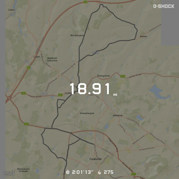
Found
myself approaching home at about 7pm on 17 miles or so with no
realistic prospect of a thunderstorm happening – plenty of blue skies
and only a few benign-looking bright clouds – so I cruised into
Coalville for a bit, then down the road to Ibstock. Back on 18.91 miles.
9:05pm as I type and the threatened thunderstorm has yet to commence.
I used the G Shock to track the ride again as a test, and once again the Casio web “service” has absorbed it like a black hole. So the following is pretty much the only evidence I’m able to submit at this time:
Finished my Jack Reacher novel audiobook. Turned out to be an excellent cycling companion. I think I’ll invest in the next one. There are thirty-one Reacher novels, enough to keep me going for a while. Not sure if all of them are available as audiobooks, though.
UPDATE : the activity did eventually make it through to Strava:
Wanted to do 40 or 50 yesterday. I’d done a bit more than 70 on Friday,
and there was a fair old wind blowing from the north-east. I set off on
the eastbound route toward Belvoir Castle.
Set off at 09:45. Cold
for the first hour or so. The headwind was irritating, but otherwise
not a significant impediment to progress. I decided to go as far as
Eastwell and make another Fondo out of it. Arrived at Eastwell after 32
miles, and turned for home. By this time temperatures had improved
considerably.
Strangely, on a route I’ve done possibly a couple
of dozen times – this is my default Fondo route – I missed a turn on the
way back, which I realised when I found myself approaching a village
called Scalford. I did exactly the same thing in a car a few weeks ago.
Anyway the road seemed fairly pleasant and I had plenty of time, so I
kept on keepin’ on, thinking to do a bit of exploring. After a few miles
I was starting to think of stopping and invoking Google Maps, but
happily a sign announcing Melton Mowbray appeared in front of me.
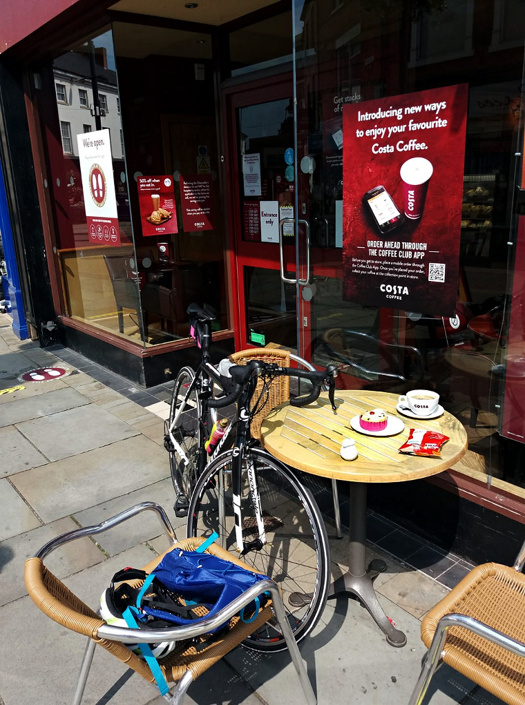
Melton has been a frequent cycling destination over the years and I certainly know my way back from there, so I continued into the centre, where I cycled cautiously over the pedestrianised area to Costa Coffee.
I
went in and ordered a bag of crisps, a Belgian bun and a coffee.
Because I was sitting at a designated table (just outside), I wasn’t
required to wear a face covering at the counter, although I had brought
one.
When I’d finished I went back in to buy a bottle of Fanta,
to replenish my bidon. It occurred to me later that because I was buying
this “to go”, I should have put the mask on. But I didn’t.
I
hadn’t done the route home from Melton since the 200-miler in June. I
did wonder how I managed the tedious climb to Six Hills after 180 miles
of pedalling. It was bad enough after 40-odd. I was waved past a pretty
bad accident involving a large farm vehicle and a van, near Six Hills,
by the Leicestershire Constabulary in attendance. I must say they were
all really friendly, with a nod and a smile. When I was a kid, coppers
were usually humourless, miserable bastards. Or maybe that’s just
Hartlepool.
Came back through Diseworth and Coleorton, just for a change. I was too hot for the last hour.
Saw
either a small rat or a large mouse scurrying across the road near
Burton on the Wolds. Then another one an hour or so later, this time
though it changed its mind half way across and retreated back into the
hedge.
Got through 12 chapters of my audiobook. Good stuff.
Reacher is a bit like Jack Bauer, there is basically no situation in
which he’s being held captive or under guard in which he won’t end up
slaughtering his captors in the most grimly efficient manner possible.
Back on 71.77 miles, a pleasing 243 already this month. But the weather looks unsettled for the next 10 days or so.
I was thinking, despite the prospect of hot weather, of doing
Northampton and back today. I got up early to give myself plenty of time
– I would probably have spent an hour or so in the town centre – and
set off at about 06:40. Getting underway at that time also gave me an
opportunity to do a sizeable proportion of the ride before the heat
kicked in.
I’d prepared the eTrex with the route, but after checking it on the Strava route planner, I decided I could probably make do with stopping and consulting Google Maps once or twice, so I left the eTrex at home to save weight. I certainly know the way well enough down as far as Gilmorton, this being the “southbound route”.
I got to Welford by about 10:00, then I decided
it was just going to be too hot a day to do the whole Northampton ride.
After a snack on a bench there, I turned back. I was wearing a
long-sleeved jersey to protect myself from the sun (and because I like
all the pockets). I removed the sports t-shirt I had on underneath and
stuffed it in the backpack. This meant that I had to go topless for a
few moments which is fine on a beach but feels a touch gauche in a small
town in Northamptonshire.
However
I did actually manage to find my way down to Welford and back without
checking a map at all, and the only time I went wrong was a mile from
home, when I decided to take an unfamiliar shortcut through Ellistown on
the way out. But I backtracked and recovered after half a mile.
Really too warm for cycling on the way back. But dark grey clouds rolled over about 20 miles from home, to provide a bit of relief. It actually spotted with rain very lightly for a minute. But the fierce sun was out again 10 miles later.
Stopped at Gilmorton and bought a
sandwich, a Snickers and a very nice cold lemon fizzy drink at the
village store there. Stopped to consume all of the above at the bench on
the other side of the road. They haven’t put the tables and chairs back
outside the store, yet.
Listened to my audiobook again, then 5 Live. Interesting interview with Robert Plant on Adrian Chiles’ show.
Back
on 70.52. Unfortunately I used my Casio GPS watch to record the track,
and because the Casio web service is abysmally unreliable, the track
hasn’t made it to Strava. There’s no way to connect the watch directly
to a PC and get the track off that way, unfortunately. So you’re at the
mercy of the Casio online service, and it really blows.
Anyway no doubt I’ll do another Fondo this month, and I’ll use a different device for tracking purposes.
172 miles done this month. More on Sunday, I hope.
UPDATE: the track did eventually make its way from the Casio servers to Strava:
Wanted to get in step for a Friday & Sunday strategy over the weekend, so I set off to do another 20-odd after work. The forecast warned of light rain. It was pretty windy. But at least it was warm.
It was indeed raining lightly when I set off. With the wind coming predominantly from the south, I set off on the eastbound route, thinking to do 10 or 11 in that direction, then come back. However the eastbound route is actually predominantly north-eastbound for the first few miles and the wind was actually slightly south-westish rather than southerly, so I got it in the teeth on the way back.
It
didn’t rain for long and the bike and I dried off quickly in the warm
wind. I got spotted with rain again later, but again not for long. I
changed the route up a bit by coming back through Diseworth and
Coleorton. I’d gone out through Coalville and Thringstone.
Nice
to be out on the Tricross again. Only a partly enjoyable run out, I
wouldn’t have bothered if I’d known the headwind was going to make it
such a slog in the latter stages. I could probably have chosen a less
vulnerable route.